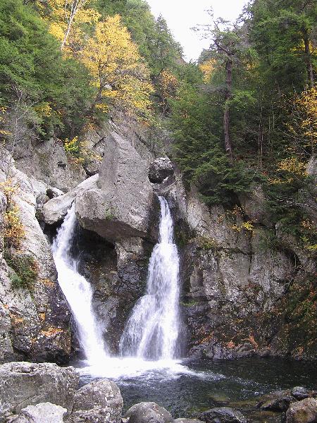
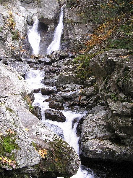
Location: Berkshire County, Massachusetts
Water Source: Bash Bish Brook
Drop: 40 Feet
Flow: Year
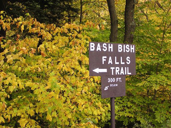
Directions: From the junction of Routes 41 and 23 at Egremont, take Rt. 41 south for .2 miles to Mt. Washington Road (sign to Bash Bish State Park 7 miles). Turn right and go 7.7 miles to Cross Road and turn right, following the sign that says Bash Bish Falls 4 miles). Go 1.7 miles to Falls Road and turn left (sign says Bash Bish Falls 2 miles). Go 1.5 miles and park in the parking area on the left. There are signs at the trailhead. An alternative route to the falls is to continue down the road another mile for an easier trail (the sign says about 20 minute to the falls and 20 minutes out).
Notes: I went to Bash Bish Falls in Massachusetts October 20, 2004. The trail from the first parking area is very rocky and steep with lots of stairs, about 1/3 mile. It was slippery in spots because it was wet. As I went down to the falls, I missed some of the blue paint trail markers on the trees, and instead of turning left to go down a steep hill to the falls, I continued straight ahead on the trail, which became more gradual, wider, and less rocky. I came to a gravel path, which I took to the left back toward the falls which I could hear. As I approached the falls, I saw the markers to the trail I missed near the falls. I took that steeper trail back to the parking area.
The trail I was on coming to the falls was the alternative route to the falls mentioned above. On the trail between the falls and where I entered it, there was another trail coming into it. A woman at the falls said she takes that trail from a park in New York.
Return to Waterfalls in Massachusetts
Page last updated 19 Nov 2004.
Email comments to dmmaki@MichelesWorld.net