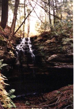
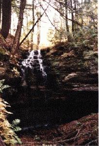
Tannery Falls
- Water Source
- Tannery Creek
- Location
- Munising, Alger County
- Size
- 40 foot drop
- Trail
- The trail on the south side of the river is "easy
walking on high ground all the way to the falls",
according to Penrose, whereas the trail behind an
abandoned house just to the north of the trailhead and
river was a "mucky quagmire most of the way."
-
- Directions
- Where M-28 makes a 90-degree turn in Munising, go east on
H-58 (Munising Avenue) about 1 1/4 mile to the
intersection with Washington Street, on the left. Just
beyond that intersection, park on the right (south) side
of H-58 across from a short blacktop road on the left
that joins H-58 and Washington Street. The trail to the
falls begins directly across H-58 from that connecting
road.
-
- Other Information
- According to Penroses' A Guide to 199 Michigan
Waterfalls, "Tannery Falls has always been a
beautiful falls but, under private ownership, was closed
to the public for many years. Thanks to the Michigan
Nature Association - which purchased the land surrounding
Tannery Falls and created a public nature preserve, which
also includes nearby Memorial Falls - it is open to the
public once again."
-
- The book also states that Tannery Falls is also called
Rudy M. Olson Memorial Falls.
Return to Waterfalls in Alger County II

Page last updated 29 Dec 2000.
Email comments to dmmaki@MichelesWorld.net