
This falls was called Scenic High Falls from signs on the road and in the visitor Guide. However, on the maps it was listed as Magpie High Falls, and on one of the signs at the falls it was called Magpie High Falls.
Directions from an article "Wawa's Waterfalls..." in Wawa Ontario, Canada Visitor Guide 98-99 put out by the Wawa Tourist Information Center gives the directions to what they call Scenic High Falls as follows:
"Location: About 2 1/2 km (1 1/2 miles) south of Wawa on Highway 17. Very well signed. Once off the highway, a gravel road (1.5 miles) leads to the bottom of the falls."
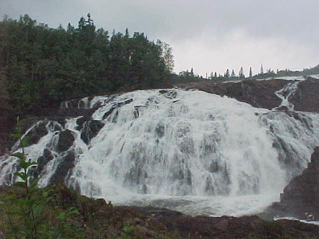
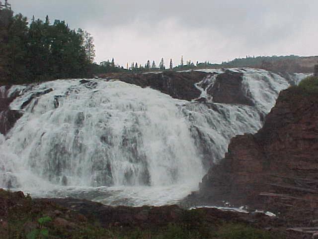
"Description: Scenic High Falls is 75 feet high and 125 feet wide. A beautiful park area is located at the base of the falls with a covered picnic shelter, BBQ, wheelchair accessible rest rooms and plenty of parking. A short walking trail which climbs to the top of the falls also provides an informative look at the history of power generation in the Michipicoten area."
The gravel road was very good (more sand than gravel) and the signs were apparently made by the power company rather than regular road signs. We found this area before we found the visitor guide, so it was quite a delight to find it!
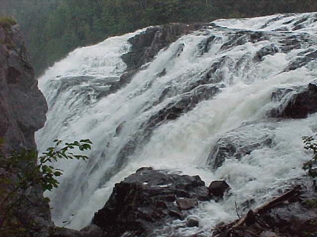
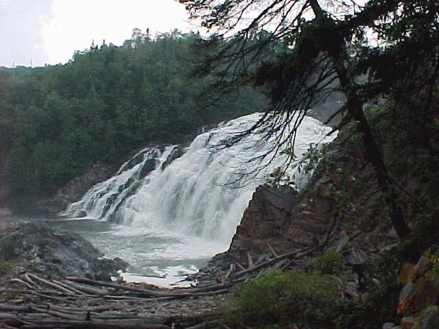
The first two pictures were from the sidewalk in front of the falls (I couldn't get the entire width in one photo). The third photo is from the side of the falls as I took the walk around the falls. The fourth photo is from farther around the falls and out to the side. The last one is from the side showing the entire falls from a distance.
![]()
![]()
![]()
![]()
The song "Waterfall Waltz" was composed and recorded by Will Bush ( vesperian@email.com ) for use on my waterfall pages. Thanks Will!
![]() Return to Waterfalls on Lake Superior
Return to Waterfalls on Lake Superior
![]()
Page last updated 28 Dec 2000.
Email comments to dmmaki@MichelesWorld.net