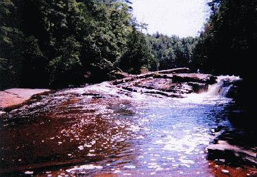
Unnamed Falls - Presque Isle River
- County
- Gogebic
- Water Source
- Presque Isle River
- Location
- Porcupine Mountains State Park
- Size
-
- Directions
- Go north on Co. Rd. 519 from M-28 in Wakefield for about
15 miles to Porcupine Mountains State Park (or follow
South Boundary Rd, to its western end in the park to
reach 519). Continue north on 519 for about 3 miles to a
parking area for the falls.
-
- Trail
- Take the paved path to the left, and again turn left at
the bottom of the stairs along the wooden walkway to view
the falls. You can get a view of the interesting rock
formation below the falls along the left bank from the
foot bridge.
-
- Other Information
- I visited this fall in the summer of 1997. When I was at
nearby Manabezho Falls in September, 1989, they were just
building this walkway, which you can now use to view the
falls. Previously you used a trail along the hillside
(that is the way the directions are in the Michigan
Waterfall book). You can now see Unnamed Falls, Manabezho
Falls, and Manido Falls from the same parking area. About
200 yards upstream Manabezho Falls, and about 100 yards
upstream from that is Manido Falls.
-
- (See Iagoo Falls, Manabezho Falls, Manido Falls, and Nawadaha Falls, in the same area.)
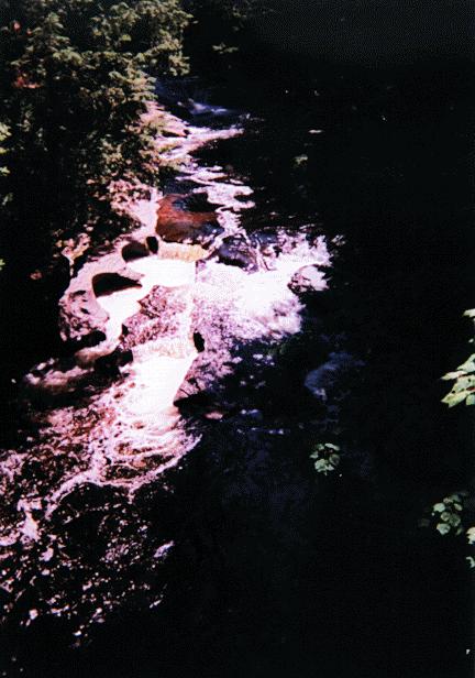
- Other Photo:
 This is a view
of the rock formations below the falls from the foot
bridge.
This is a view
of the rock formations below the falls from the foot
bridge.-
Return to Waterfalls in Gogebic County
II

Page last updated 28 Dec 2000.
Email comments to dmmaki@MichelesWorld.net

 This is a view
of the rock formations below the falls from the foot
bridge.
This is a view
of the rock formations below the falls from the foot
bridge.