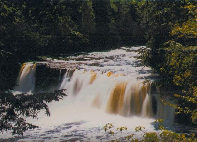
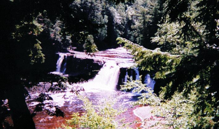
Manabezho Falls

- County
- Gogebic
- Water Source
- Presque Isle River
- Location
- Porcupine Park State Park
- Size
- 20 foot drop - 150 foot wide river
- Directions
- Go north on Co. Rd. 519 from M-28 in Wakefield for about
15 miles to Porcupine Mountains State Park (or follow
South Boundary Rd, to its western end in the park to
reach 519). Continue north on 519 for about 3 miles to a
parking area for the falls.
- Trail
- Follow the signs to the falls. It is just a short paved
trail and many steps to the falls. You can now see
Unnamed Falls, Manabezho Falls, and Manido Falls from the
same parking area. About 200 yards downstream is Unnamed
Falls, and about 100 yards upstream is Manido Falls.
- Other Information
- You can now see Unnamed Falls, Manabezho Falls, and
Manido Falls from the same parking area. About 200 yards
downstream is Unnamed Falls, and about 100 yards upstream
is Manido Falls.
-
- (See Iagoo Falls, Manabezho Falls, Manido Falls, Nawadaha Falls, and Unnamed Falls in the same area.)
- Other Photos
 Here's another photo of Manabezho Falls.
Return to Waterfalls in Gogebic County I

Page last updated 28 Dec 2000.
Email comments to dmmaki@MichelesWorld.net
 Here's another photo of Manabezho Falls.